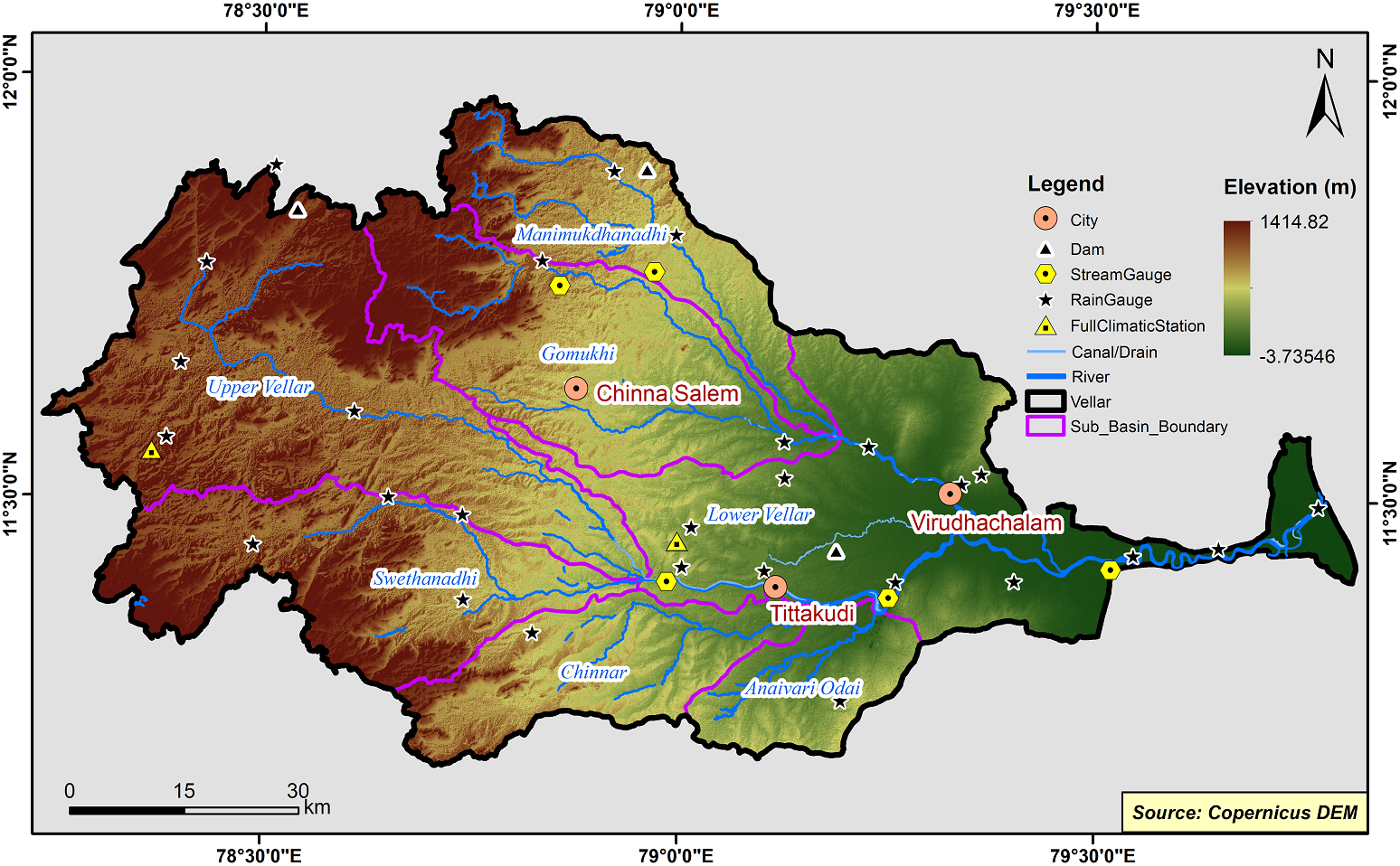
Vellar Basin
The Vellar river basin is one of the seventeen river basins of Tamil Nadu. The Vellar River has its origin from three rivers. (i)Anaimaduvu river originates from Velanguttu hills at an altitude of 1122m and flows from west to southeast direction in Salem district (ii) Thumbal river originates from Thumbal hills at an altitude of 772m. It gains its name as Kallar river at Idayapatti [Long 78˚29’29”E, Lat 11˚45’6”N] and confluences with Anaimaduvu river at Ramanatham village [Long 78˚25’49”E, Lat 11˚41’35”N] in Salem district (iii) Singipuram river originates from Tengal hills, Jambuttu hills and Perumal hills of Attur taluk of Salem district, and joins the confluenced river of Kallar and Anaimaduvu at Vaittikavundan pudur[Long 78˚26’47”E, Lat 11˚39’31”N] and travels as Vasista Nadhi upto Kalpaganur[Long 78˚32’26”E, Lat 11˚37’57”N] and thereafter the river is called as Vellar river. Ellar river originating from Velliyur village [Long 78˚46’36”E, Lat 11˚28’45”N] at an elevation of 160m joins Vellar river near Mettur village [Long 78˚54’25”E, Lat 11˚27’45”N]. The major tributaries, viz., Swethanadhi, Chinnar river, Anaivari odai, Gomukhi river, Manimuktha river and Periyaodai are joining with Vellar river and the river flows through Dharmapuri, Salem, Namakkal, Trichy, Perambalur, Ariyalur, Villupuram, Cuddalore districts and finally confluences with the Bay of Bengal.
Vellar basin consists of 10 Sub-Basins and their areal extent are as follows
|
Name of the Sub-basins |
Total area of the Sub-basin (km2) |
|
Anaivari Odai |
370.17 |
|
Chinnar |
639.62 |
|
Gomukhi |
1157.36 |
|
Lower Vellar |
1715.92 |
|
Manimukdhanadhi |
724.90 |
|
Swethanadhi |
1031.10 |
|
Upper Vellar |
1827.87 |
 |
|---|
|
|
Hydrological Variables
Base Period (1985-2014) Near Century (2021-2050)
PCP - Precipitation; SURQ - Surface Runoff; ET - Evapotranspiration - All units are in mm
Climate Risk
Base Period (1985-2014) Near Century (2021-2050)

