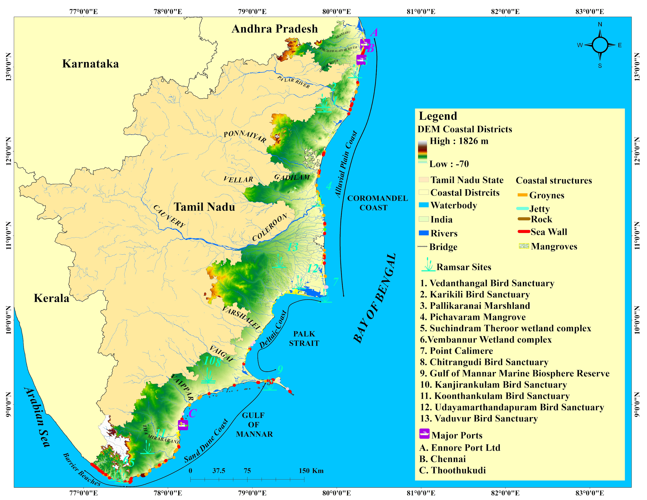
Tamil Nadu Coastal Ecosystem
The 14 coastal districts of Tamil Nadu are bounded by the Bay of Bengal in the East, the Arabian Sea in the west and the Indian Ocean in the south. The coastal length of Tamil Nadu is categorized into Coromandel coast from Pulicat to Point Calimere 357.2 km, Palk Bay from Point Calimere to Pamban 293.9 km, Gulf of Mannar from Pamban to Kanyakumari 364.9 km and west coast in Arabian sea from Kanyakumari to Neerodi 60.0 km (Report: TN fisheries, 2022).
The coasts are highly productive areas providing the nation’s economic growth, and livelihood opportunities. The highly dynamic coastal environment is under threat due to climate change-induced extreme waves, cyclones, sea level rise, and coastal flooding.
|
S. No |
Districts |
Coast Length in km |
|
1 |
Tiruvallur |
34.52 |
|
2 |
Chennai |
39.51 |
|
3 |
Chengalpattu |
74.58 |
|
4 |
Villupuram |
33.69 |
|
5 |
Cuddalore |
41.50 |
|
6 |
Mayiladuthurai |
49.77 |
|
7 |
Nagapattinam |
81.90 |
|
8 |
Tiruvarur |
22.44 |
|
9 |
Tanjavur |
43.27 |
|
10 |
Pudukkottai |
43.55 |
|
11 |
Ramanathapuram |
275.71 |
|
12 |
Thuthookudi |
118.88 |
|
13 |
Tirunelveli |
53.10 |
|
14 |
Kanyakumari |
71.28 |
 |
|---|
Sea Level Rise
Projected SLR under different Pathways
Coastal Impacts
Shoreline Changes (1992-2022) Inundataion due to SLR (2021-2050)
Climate Risk
Baseline (1985-2014) Near Century (2021-2050)

