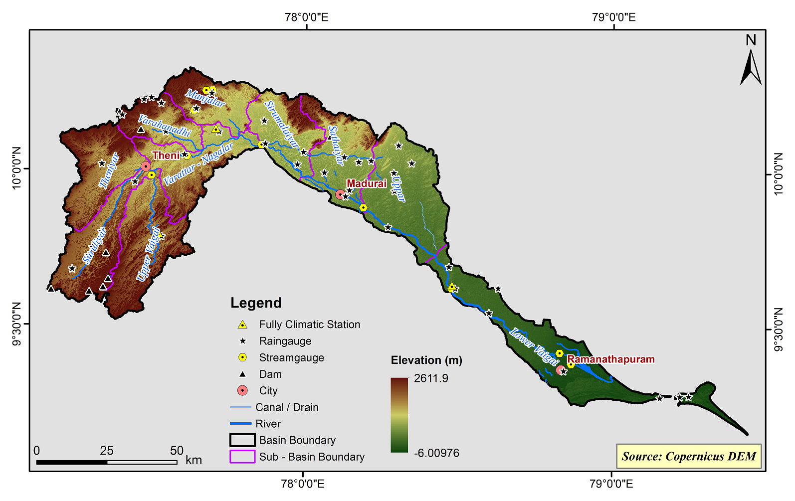
Vaigai Basin
Vaigai river basin covers an area of about 7009.13 sq.km and hilly area extends to 2,101.68 sq.km and located in the Theni, Dindugal, Madurai, Sivaganga, and Ramanathapuram Districts of Tamil Nadu. Vaigai river basin lies between the geographic co-ordinates Lat. 9° 15’ – 10° 20’ N and Long. 77° 10’ - 79° 15’Vaigai, the main river originating from Varushanadu valley with its tributaries forms a well-defined, compact drainage basin. It has a varied climatic condition resulting often in unreliable rainfall, drought prone, sudden floods, etc. This gives rise to unpredictable water resources condition but for the Periyar reservoir water flowing through this basin due to the construction of the Periyar trans-basin scheme which made it possible to divert water from the Periyar basin in the State of Kerala to Tamil Nadu.
Vaigai basin consists of 10 Sub-Basins and their areal extent are as follows
|
Name of the Sub-basins |
Total area of the Sub-basin (km2) |
|
Lower Vaigai |
1117.29 |
|
Manjalar |
470.37 |
|
Sathaiyar |
669.76 |
|
Sirumalaiyar |
535.19 |
|
Suruliyar |
649.80 |
|
Theniyar |
646.81 |
|
Uppar |
966.47 |
|
Upper Vaigai |
800.89 |
|
Varahanadhi |
391.95 |
|
Varattar - Nagalar |
637.85 |
 |
|---|
|
|
Hydrological Variables
Base Period (1985-2014) Near Century (2021-2050)
PCP - Precipitation; SURQ - Surface Runoff; ET - Evapotranspiration - All units are in mm
Climate Risk
Base Period (1985-2014) Near Century (2021-2050)

