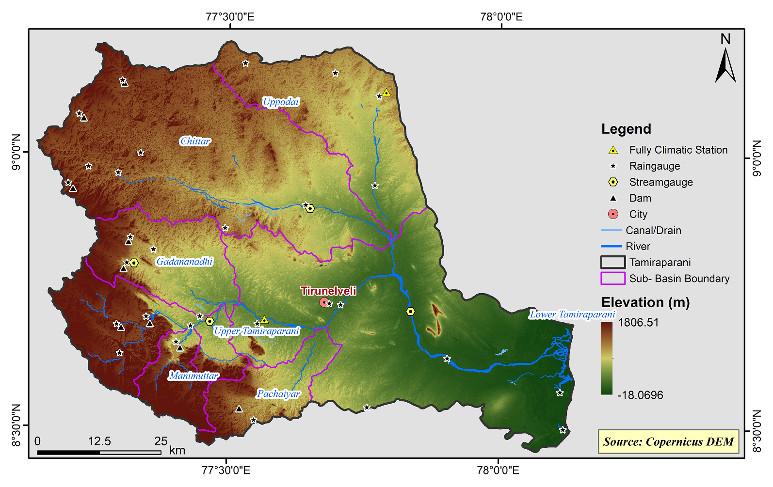
Tamirabarani Basin
The Tamiraparani River Basin is one of the 17 river basins and having 7 sub basins and covers the district of Tirunelveli and Thoothukudi.Tamiraparani River Basin lies between geographic co-ordinates N. lat.8° 26’ 45” to 9° 12’ 00” and E. long 77° 09’ 00” to 78° 08’30”. The entire basin covers an area of about 5717.08 sq. km and lies in the revenue districts of Tirunelveli, Thoothukudi taluk of Thoothukudi District in southern Tamil Nadu.
Tamiraparani basin consists of 7 Sub-Basins and their areal extent are as follows
|
Name of the Sub-basins |
Total area of the Sub-basin (km2) |
|
Chittar |
1662.50 |
|
Lower Tamiraparani |
1891.64 |
|
Upper Tamiraparani |
514.33 |
|
Gadananadhi |
446.83 |
|
Manimuttar |
191.54 |
|
Pachaiyar |
288.66 |
|
Uppodai |
721.70 |
 |
|---|
|
|
Hydrological Variables
Base Period (1985-2014) Near Century (2021-2050)
PCP - Precipitation; SURQ - Surface Runoff; ET - Evapotranspiration - All units are in mm
Climate Risk
Base Period (1985-2014) Near Century (2021-2050)

