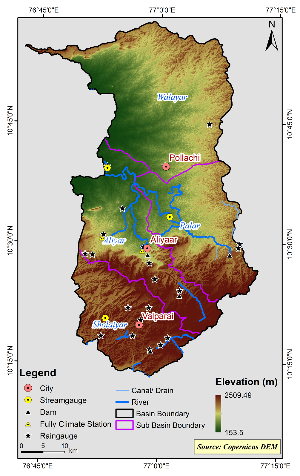
Parambikulam Aliyar (PAP) Basin
Parambikulam-Aliyar (PAP) basin is located in the south western part of the Peninsular India, and covers area in Kerala and Tamil Nadu States.Aliyar river rises in the eastern slopes of Anamalai hills of the Western Ghats in Coimbatore district at an elevation of 2250 m above msl and flows in the north-westerly direction on its 45 km runs from its origin, it is joined by a tributary namely the Palar river on its right bank traversing by another 15km west wards, it enters the Palaghat district of Kerala State through Palghat gap. PAP river basin has an undulating topography with maximum contour elevation in the plain is 300m. and the maximum spot height in the plain is 385m above MSL. One third of the basin area (822.73 sq.km) is covered with hills and dense forest cover. The total area of PAP basin is 2388.72 sq.km. This basin is bounded in north and east by Cauvery basin, south and west by Kerala State. This basin area lies (except the ayacut area) within the coordinates of N .latitude between 10° 10’ 00” to 10°57’20” and E .longitudes 76°43’00” to 77° 12’30”.
PAP basin consists of 3 Sub-Basins and their areal extent are as follows
|
Name of the Sub-basins |
Total area of the Sub-basin (km2) |
|
Aliyar |
564.54 |
|
Palar |
520.60 |
|
Sholaiyar |
446.11 |
|
Walayar |
875.13 |
 |
|---|
|
|
Hydrological Variables
Base Period (1985-2014) Near Century (2021-2050)
PCP - Precipitation; SURQ - Surface Runoff; ET - Evapotranspiration - All units are in mm
Climate Risk
Base Period (1985-2014) Near Century (2021-2050)

