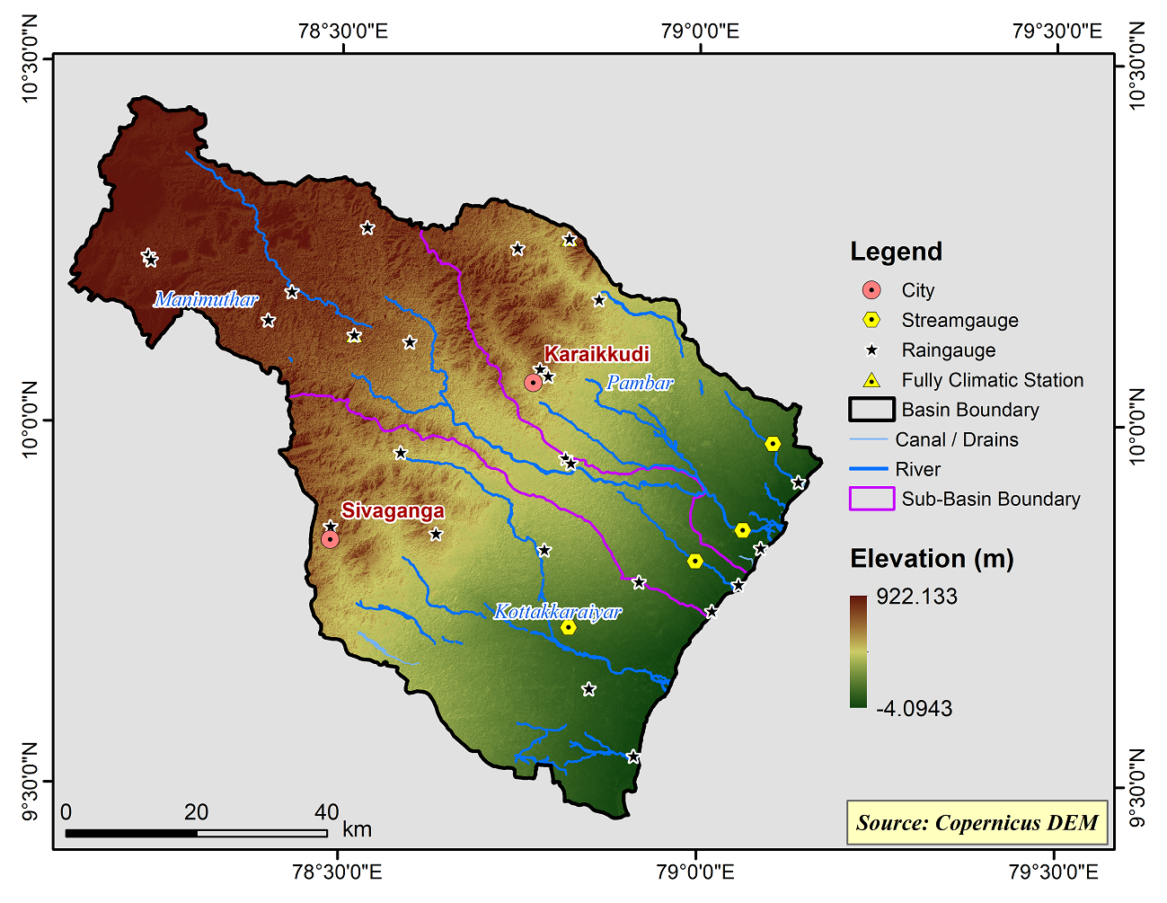
Pambar Kottakaraiyar Basin
Pambar and Kottakkaraiyar basin is one among the 17 river basin of Tamilnadu. It is located in the South Central Portion of Tamilnadu. In the northwestern portion of the study area is covered by discontinuous hillocks of Eastern Ghats mountain ranges. They are ‘relict’ mountains. The important hillocks are Alagar hills (829m), Karandamalai (913m), Ayyalur hills (9578m), Sirumalai hills (eastern part only) (835m) and Kodangikkuttu hills (642m). The remaining part of the basin area is gently slopping topography. The study area is slopping towards south east direction. This is an elongated basin in the East-West direction. The basin area is bounded north by Agniyar basin, northwest by Cauvery basin, south by Vaigai basin and east by Palk Bay. The basin is located in the geographical co-ordinates of 9° 30’ 00” N to 10° 25’00’’ N Latitudes and 78° 10’ 00’’E to 79° 00’ 00’’E longitudes and an aerial extent of 5910.87 km.
Pambar and Kottakkaraiyar Basin consists of 3 Sub-Basins and their areal extent are as follows
|
Name of the Sub-basins |
Total area of the Sub-basin (km2) |
|
Kottakkaraiyar |
2206.54 |
|
Manimuthar |
2278.58 |
|
Pambar |
1441.83 |
 |
|---|
|
|
Hydrological Variables
Base Period (1985-2014) Near Century (2021-2050)
PCP - Precipitation; SURQ - Surface Runoff; ET - Evapotranspiration - All units are in mm
Climate Risk
Base Period (1985-2014) Near Century (2021-2050)

