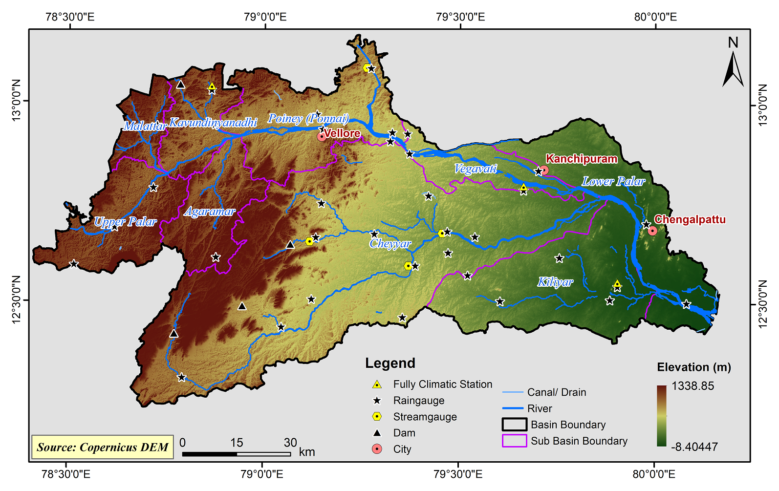
Palar Basin
The Palar River Basin is one of the major river basins in Tamilnadu. The main Palar River originates in Nandhi Durg, Kolar district at an elevation of 800 m above MSL in eastern part of Karnataka State, through Kolar and Bangarupet Taluks where it forms the very large Bethamangal tank, which is the main source of water supply to Kolar Gold Field and Bharath Earth Movers Limited. It leaves Karnataka border and flows through Andhra Pradesh for a small distance in Kuppam Taluk in Chitoor District and enters Vellore District of Tamil Nadu and passes through west of Vaniambadi Town and flows into the Bay of Bengal, east of Maduranthagam and south of Mahabalipuram. The total area of Palar River Basin is 17,633.19 sq.km which includes an area of 3,123 sq.km in Karnataka state, 4,267 sq.km in Andhra Pradesh and 10273.19 Sq Km in Tamil Nadu. It lies between 78°24’43” E, 12°36’26” N and 80°09’54” E, 12°31’26” N from east to west and between 79° 14’23”E, 13°10’21” N and 78°41’51” E, 12°14’05” N in north to south.
The Palar Basin consists of 8 Sub-Basins and their areal extent are as follows
|
Name of the Sub-basins |
Total area of the Sub-basin (km2) |
|
Agaramar |
581.28 |
|
Cheyyar |
4372.18 |
|
Kavundinyanadhi |
466.64 |
|
Kiliyar |
1324.93 |
|
Lower Palar |
1044.70 |
|
Malattar Poiney (Ponnai) |
265.84 1092.65 |
|
Upper Palar |
736.18 |
|
Vegavati |
425.04 |
|
Agaramar |
581.28 |
 |
|---|
|
|
Hydrological Variables
Base Period (1985-2014) Near Century (2021-2050)
PCP - Precipitation; SURQ - Surface Runoff; ET - Evapotranspiration - All units are in mm
Climate Risk
Base Period (1985-2014) Near Century (2021-2050)

