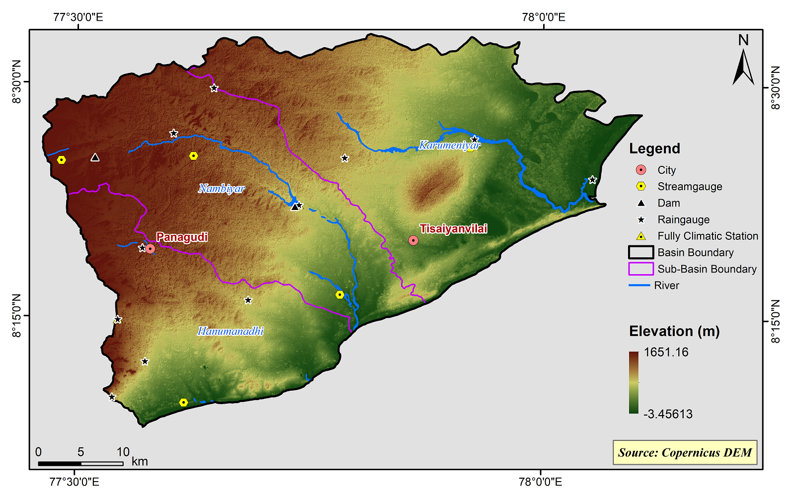
Nambiyar Basin
The Nambiyar basin falls in Tirunelveli, Thoothukudi and Kanyakumari districts. There are three rivers in this basin. The Karamaniyar is in the northern part of the basin and Hanumanadhi river is in the southern part of the basin and the Nambiyar river is in between these two rivers. Tamiraparani basin on north and Kodaiyar basin on south and the Gulf of Mannar on the east surround this basin. It lies between the following co-ordinates. North[1]Latitudes 08° 08’00” - 08° 33’ 00” and East - Longitude 77° 28’00” - 78° 15’ 00”
The Nambiyar Basin consists of 3 Sub-Basins and their areal extent are as follows
|
Name of the Sub-basins |
Total area of the Sub-basin (km2) |
|
Nambiyar |
677.32 |
|
Karumeniyar |
852.69 |
|
Hanumanadhi |
470.74 |
 |
|---|
|
|
Hydrological Variables
Base Period (1985-2014) Near Century (2021-2050)
PCP - Precipitation; SURQ - Surface Runoff; ET - Evapotranspiration - All units are in mm
Climate Risk
Base Period (1985-2014) Near Century (2021-2050)

