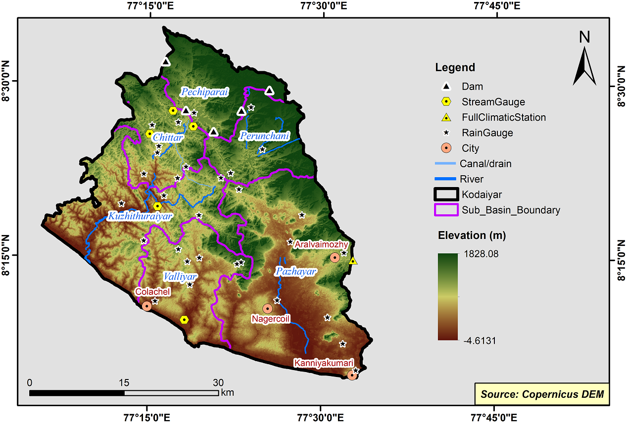
Kodaiyar Basin
The Kodaiyar river basin forms the southernmost end of Indian peninsula. The basin covers an area of 1646.964 sq km. The flanks of the entire basin falls within the TamilnaduState boundary. Tamiraparani basin lies on the north and Kodaiyar basin on the east and Neyyar basin of Kerala State lies on the west. This is the only river basin which has its coastal border adjoining the Arabian sea, the Indian Ocean in the south and the Gulf of Mannar in the east. sLatitude: 08º 04’ 34” - 08º 34’ 35” and Longitude: 77º 05’ 53” - 77º 35” 39”. The entire basin falls in the territory of Kanyakumari district and a small portion falls in Radhapuram block of Tirunelveli district.
The Kodaiyar Basin consists of 6 Sub-Basins and their areal extent are as follows
|
Name of the Sub-basins |
Total area of the Sub-basin (km2) |
|
Chittar |
166.60 |
|
Kuzhithuraiyar |
344.96 |
|
Pazhayar |
559.66 |
|
Pechiparai |
170.72 |
|
Perunchani |
162.60 |
|
Valliyar |
214.32 |
 |
|---|
|
|
Hydrological Variables
Base Period (1985-2014) Near Century (2021-2050)
PCP - Precipitation; SURQ - Surface Runoff; ET - Evapotranspiration - All units are in mm
Climate Risk
Base Period (1985-2014) Near Century (2021-2050)

