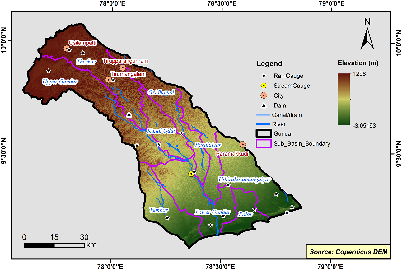
Gundar Basin
Gundar river basin is one of the major river basins of Tamil Nadu with a drainage area of 5690 sq.km. It is located between the geographic co-ordinates N Latitude 9°05’ - 10° 03’ and E Longitude 77° 35’E - 78° 35’. It is sand witched between Vaigai river basin in the north and Vaippar river basin in the south. The length of the Gundar river is 150 kms. This is a fairly elongated basin and elongated in the northwest to southeast direction. The basin covers part of Madurai, Sivagangai, Virudhunagar, Ramanathapuram and Thoothukudi districts.
The Gundar Basin consists of 9 Sub-Basins and their areal extent are as follows
|
Name of the Sub-basins |
Total area of the Sub-basin (km2) |
|
Gridhamal |
584.24 |
|
Lower Gundar |
773.12 |
|
Palar |
269.56 |
|
Kanal Odai |
380.18 |
|
Paralaiyar |
429.01 |
|
Therkar |
915.78 |
|
Upper Gundar |
1084.20 |
|
Uthirakosamangaiyar |
735.05 |
|
Vembar |
563.71 |
 |
|---|
|
|
Hydrological Variables
Base Period (1985-2014) Near Century (2021-2050)
PCP - Precipitation; SURQ - Surface Runoff; ET - Evapotranspiration - All units are in mm
Climate Risk
Base Period (1985-2014) Near Century (2021-2050)

