IRS IN NEWS
Transformation of College of Engineering
24-Mar-2022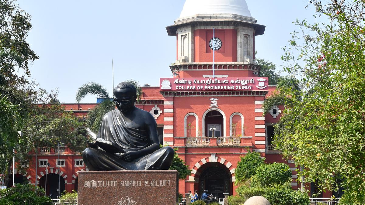
Survey School, which was started with just eight students, has become College of Engineering, Guindy. The institution, founded as the Survey School in Fort St. George by Michael Topping with just eight students hand-picked from the orphan asylum functioning in the coastal city, has transformed into the prestigious College of Engineering, Guindy (CEG) today, a constituent campus of Anna University.
More..Flood Mitigation Panel for Chennai City
14-Nov-2021
The Governor had in his address to the Assembly announced that a Chennai Metro Flood Management Committee, comprising experts in environment, urban planning and disaster management would be established to devise flood control methods and design storm water drains to reduce the detrimental impact of floods. Dr.D.Thirumalaivasan of Institute of Remote Sensing in Anna University...
More..Now, online portal to geo-tag industrial polluters in Tamil Nadu
04-Sep-2021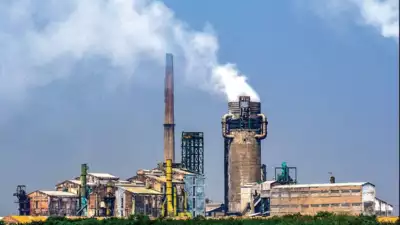
Authorities in the state can now monitor the various industries including those categorized as 'red' at the click of a mouse. The Tamil Nadu Pollution Control Board is set to launch, with the help of Institute of Remote Sensing(IRS) at Anna University, a 'Web based geo spatial services' portal that will use satellite maps to keep tabs on industries categorized according to their functioning
More..Survey on to finalize location for excavation
23-Jan-2021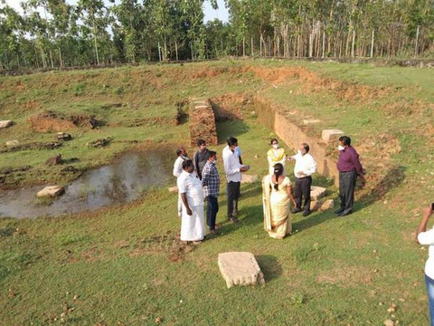
The State Department of Archaeology has commenced a field survey to identify potential locations for excavation at Gangaikondacholapuram-Maligaimedu and surrounding villages in Ariyalur district. The survey comes in the wake of the decision of the department to launch excavations at seven more sites in the State. On Friday, an agency authorised by the Institute of Remote Sensing of the Anna University joined the officials with drone and thermal cameras to conduct the survey.
More..Aerial survey on for excavation in Gangaikonda Cholapuram
23-Jan-2021The state archaeological department on Friday launched a field study in the vicinity of Gangaikonda Cholapuram in Ariyalur district to commence archaeological excavations next month. The study in collaboration with various educational institutes and using unmanned aerial vehicle (UAV) will look for potential places for unearthing the archaeological remains of Chola dynasty, particularly of emperor Rajendra Chola I. Resource persons from the Central University of Tamil Nadu, Institute of Remote Sensing, Anna University and Madurai Kamaraj University were involved in the field study.
More..Chennai: Institute of remote sensing helps state govt to map Covid-19 cases
15-Mar-2020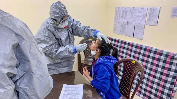
The Institute of Remote Sensing which comes under Chennai's Anna University is helping the state government agencies to map Covid-19 positive cases in the state. When data comes in, the team physically marks it into the maps. Experts are using this data to prepare a grid that will help the state agencies work on their containment zones and buffer zones and also help them with how to operate resources.
More..Anna University to develop grids for Covid-hit areas - Times of India
09-Mar-2020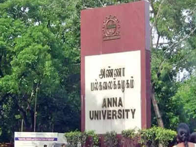
In an effort to boost its micro containment plan, the health department is using Anna University’s technical expertise to mark a grid that would help estimate households which would come within the containment zone and buffer zone around the epicentre. Experts from the university’s Institute of Remote Sensing (IRS) will prepare grids for more than 700 Covid-19 cases in Tamil Nadu and also for cases with symptoms to contain the virus spread.
More..Universities for Master’s in Geo-informatics/GIS
03-Mar-2020
Are you thinking about pursuing Master’s in GIS, Remote Sensing or Geoscience? Never think twice, we have made a comprehensive list of many universities for Master’s in GIS, Geo-informatics, and related fields. The courses form a spectrum ranging from GIS to Geoengine or from Applied Science to Geoscience.
More..'Red Atlas Map' unveiled for flood mitigation
04-Nov-2019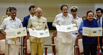
Vice-President M Venkaiah Naidu on Sunday unveiled the 'Red Atlas Action Plan Map,' a first of its kind ready reckoner, prepared by the Ministry of Earth Sciences to aid Tamil Nadu government in effective flood mitigation in Chennai which witnessed the worst deluge in 2015. The office of the Principal Scientific Advisor to the government of India, IIT Madras, IIT-Bombay and the Institute of Remote Sensing of the Anna University participated from the academia.
More..Safeguard water bodies from urbanization reach to end Chennai's perpetual water shortage
31-Mar-2019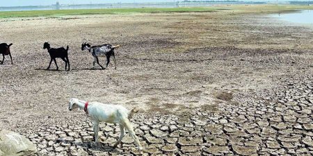
The answer to Chennai’s repeated struggles of sourcing enough drinking water lies within restoring and protecting water bodies that are rapidly vanishing. A recent study funded by the Central government’s Department of Science and Technology, has ascertained this as the most viable solution for ending the city’s perpetual water shortage. On analyzing images provided by Anna University’s Institute of Remote Sensing (IRS) in the years 2008 and 2017, most water bodies in Kancheepuram were falling prey to encroachment while the ones in Tiruvallur were vanishing due to lack of restoration by the government.
More..What careers to choose after Geoinformatics?
03-Jan-2019
Geoinformatics holds great promise in environmental modelling and its analysis, studying climate change, disaster management, and telecommunications, writes Dr Ketan Kotecha, Director, Symbiosis Institute of Technology, for Elets News Network (ENN).
The best thing about this field is that it covers an array of sectors. Starting from public sector to private sector, different work styles can be used to become masters in this field. This industry covers an array of fields. One can spend his time outside tracking wildlife in the Arctic, or tracking down insurance fraud in the Southern part of Europe; location intelligence is a hot trend in this industry.
Andamans to get undersea cable
24-Dec-2018
A proposal to provide high speed internet to the Andaman and Nicobar Islands in order to augment their communication infrastructure especially during natural disasters through an under-sea optical fibre cable system from Chennai has been cleared by an expert committee of the Ministry of Environment, Forest and Climate Change (MoEF). All 8 BMHs and 3 CLS are falling within the Island Coastal Regulation Zone (ICRZ) area as per the survey conducted by Institute of Remote Sensing (IRS), Anna University, Chennai,” the minutes of the EAC meeting read.
More..Wetlands authority notified
21-Dec-2018The State government on Thursday notified Wetlands Authority of Tamil Nadu under the Wetlands (Conservation & Management) Rules, 2017 notified by the Union Ministry of Environment, Forests and Climate Change. With Minister for Forests as its Chairperson, the Chief Secretary as its Vice-Chairperson, Secretaries from various departments, including Environment and Forests, Housing, Rural Development and Public Works, will be the ex-officio members alongside the Tamil Nadu Pollution Control Board Member Secretary. Professor and Director of Institute of Remote Sensing, Anna University, Principal Chief Conservator of Forests and Chief Wildlife Warden, Member Secretary of Tamil Nadu Bio-diversity State Board, Additional Principal Chief Conservator of Forests of the Regional Office of Ministry of Environment, Forests and Climate Change are the other ex-officio members.
More..Careers in GIS and Remote Sensing
14-Oct-2018
Top Institutes in India (PG) for GIS and Remote Sensing
1. Indian Institute of Remote Sensing, Dehradun – M.Tech in Remote Sensing and GIS
2. Indian Institute of Technology Bombay – M.Tech in Remote Sensing
3. Indian Institute of Technology (IIT), Kharagpur, Kanpur, and Roorkee – Department of Geoinformatics
4. Institute of Remote Sensing, Anna University, Chennai – M.Tech in Remote Sensing, B.E & M.E in Geoinformatics
Anna Univ researchers to predict landslides in Uttarakhand area
15-Aug-2016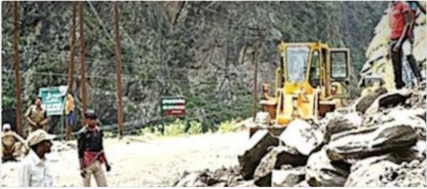
In an attempt to give some relief to people of disaster-prone Uttarakhand, the Union government has roped-in the Institute of Remote Sensing (IRS) in Anna University to predict the occurrence of landslides in the Himalayan region to enable the local administration initiate appropriate measures that would save several lives.
More..Scientists to study twister in Tamil Nadu monsoon
06-Jan-2016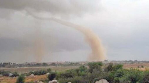
It’s rare to hear the news of tornado or twister reported in India, especially in South India. However, this northeast monsoon , labeled as ‘once in a century’ extreme rainfall event, saw a weak twister hitting a village in Sankarankoil in Tirunelveli damaging a few houses on November 18. The rare occurrence has largely gone unreported, but now the researchers are chancing upon the opportunity to study the event for deeper understanding. Scientists at Centre for Climate Change and Adaptation Research of Anna University and Indian Institute of Tropical Meteorology are likely to do a case study, but the challenge would be to get the radar images.
More..Floods expose how Chennai killed its drains
25-Nov-2015
Chennai has seen nearly four floods in the last 30 years, yet the city found itself ill-prepared for the recent rains that started on November 8. The heavy downpour that began two days before Diwali inundated large parts of Tamil Nadu, particularly the coastal districts of Cuddalore, Kancheepuram, Chennai and Tiruvallur. The Corporation will work with Anna University, Indian Institute of Technology Madras and Institute of Remote Sensing to create better models to manage rain, Kapur adds.
More..Today, 213 Years Ago Began the Epic Survey That Sized up India
10-Apr-2015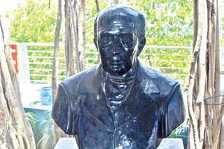
From a spot on top of St Thomas Mount on April 10 began an epic 2,400 km journey that mapped the ends of the country. An expedition that criss-crossed hill and vale, traversed forest and harsh terrain, from Kanyakumari in the South to the Himalayas in the North. A journey that found that Peak XV with no known local name was the tallest in world, which earned them the right to name it after the the previous leader of the expedition, George Everest. The entire survey could have involved up to 40,000 people and the work claimed many lives,” says S S Ramakrishnan, Director, Institute of Remote Sensing, Anna University. He adds that the manpower for the survey came from students of the Survey School in Fort St George.
More..CRCSI and Anna University India sign an MOU
12-May-2014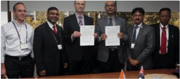
CRCSI Australia have entered into an agreement with Institute of Remote Sensing at Anna University, India to explore collaboration in various areas of research.
More..25 automatic weather stations to be set up
23-Nov-2010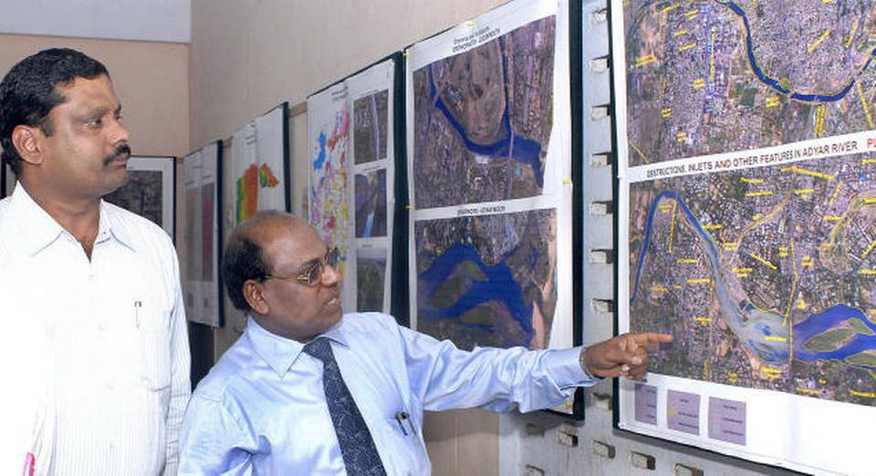
Twenty five automatic weather stations will be set up across the city to develop an early warning system for flood monitoring. The data would be used to provide information about the areas that are likely to be inundated and help the authorities plan evacuation and rescue measures. Two control rooms would be set up – at the Institute of Remote Sensing (IRS), Anna University and in Ripon Building - that would transmit data and deliver flood warning inputs such as extent of inundation according to increase in flow at waterways.
More..Mapping shows elevated roads and subways blocking rainwater - Times of India
23-Nov-2010Flooding in Chennai is mainly caused due to railway lines, elevated highways and subways, which hinder the normal drainage of rainwater. This is one of the conclusions established by a detailed flood-risk mapping undertaken for the city and its suburbs by Anna University's Institute of Remote Sensing (IRS).
More..